
Boaters can get their feet wet around the Hudson Valley by following a new map.
“The map is illustrated with original art works by noted Hudson Valley artists featuring scenes painted along the river,” President of BillsMaps, Inc. Bill Newman said.
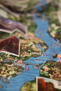
The Mid & Upper Hudson River Estuary Map runs from Peekskill to Troy. It pinpoints places of interest, such as marinas, boat clubs, farmers’ markets and historic sites. Along the way, there are artists’ renditions of paintings that give the visitor an idea of what to expect when they dock in a nearby, geographical hub of activity.
Fred LeBrun, columnist from The Albany Times Union, said the map offers updated information about the landscape.
“A pretty and practical trove of the useful and delightful about the Hudson Valley, from Peekskill to Waterford,” he said. “A fine map and guide offering a fresh, up-to-date look at a familiar and beloved riverscape.”
Newman said that the map was a collaborative effort among “many minds and hands.”
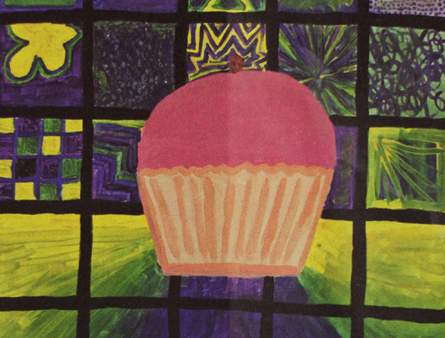
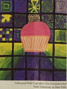
One painting featured that was done by a New Paltz student depicted a desert called Unbound Pink Cupcake. Third-year anthropology major Zoë Krumanocker painted the sweet treat for the map.
“I did the painting as a reflection of my enormous sweet tooth, and love of cupcakes!” she said. “The Hudson Valley certainly has an abundance of wonderful bakeries, many of which [Newman] included on his map.”
The pink cupcake contrasts with the color scheme of the background which primarily consists of blue, green and yellow tiles. According to the map, the cupcake sits above a list of the “Hudson Valley’s Yummiest Bakeries.”
Krumanocker said she was glad to be featured on the map and that her work can highlight the culinary side the Hudson Valley has to offer.
“I am delighted that they are being recognized on the estuary map, and that my artwork can accompany these tasty Hudson Valley hot spots,” she said.
Most of the other portraits on the map highlight the scenic views of the valley such as river-front properties, wetlands, increasingly elevating mountains and docked ships among other scenes.
Mayor of Peekskill Mary Foster said that the map is useful and a “must have for all boaters.” She praised Newman’s efforts for taking the time and crafting it.
“He has a unique appreciation of the local Hudson River communities and the amenities they offer,” Foster said.
The map goes into detail of where boaters can dock and explore the city, such as in Albany, N.Y. This includes bus routes with the idea that boaters will be on foot.
However, the map makes it clear that its intended purpose is recreational and is not to be used as a means of navigation for boaters.
Newman said for more information on lodging and boating activities in the Hudson River Valley, to visit billsmaps.com.

No link to the map? And the link to bitsmaps.com is broken